Commercial Drone Services
As we encounter new challenges, using new technologies is not an option, it’s a necessity. Aerial Scanning offers a remarkable blend of innovation and practicability.
From Construction Site Monitoring, Environmental Assessments, Infrastructure Inspection, and Building Information Modeling, DGN specializes in bringing you valuable data, fast and efficiently.
Construction Progress Monitoring
Construction Progress Monitoring
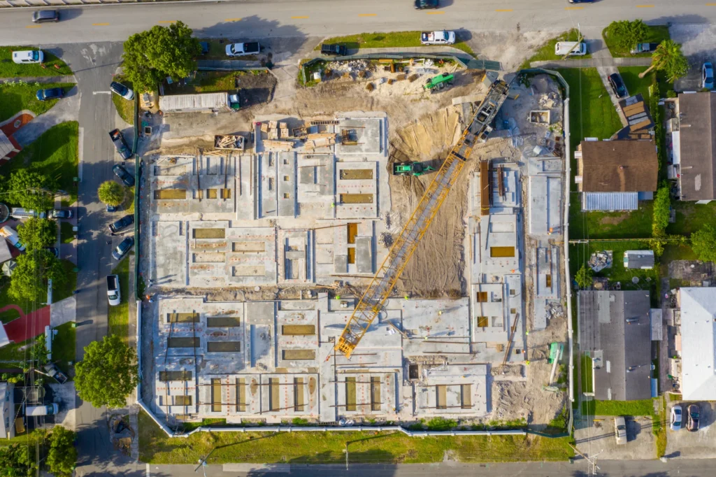
Drones in Construction
Among the technological innovations within the last decade, drones have emerged as a popular tool in construction for optimizing workflow, improving coordination between professionals, and mitigate risk at the job site.
The construction industry has been marked as one of the industries that can see significant improvements in performance and efficiency in a range of practical aspects- such as pre-planning, detailed survey, mapping of job site, construction monitoring, post-build checks, and sales and marketing.
With successful implementation and utilization of the data and tools provided, our services can increase safety at the job site, reduce risk factors, increase profitability, save time, and collect virtual data that you can use for decades in future development, planning, and marketing.
DGN robotics can provide fully automated, agreed flight paths of the site to provide near real time visual progress reporting for developers, stakeholders, and the people on site as a live progress record.
You can do this at any point of development phase, even before construction at the site begins. Key milestones in construction can be recorded at discussed timestamps and update those who are concerned, increasing accountability and displaying progress at the worksite.
Regular Updates
Delivered to you directly or via web viewer.
Documentation
Independent & detailed Quality Control from all angles,
Fast Data
Once automated, your results can be delivered in a day.
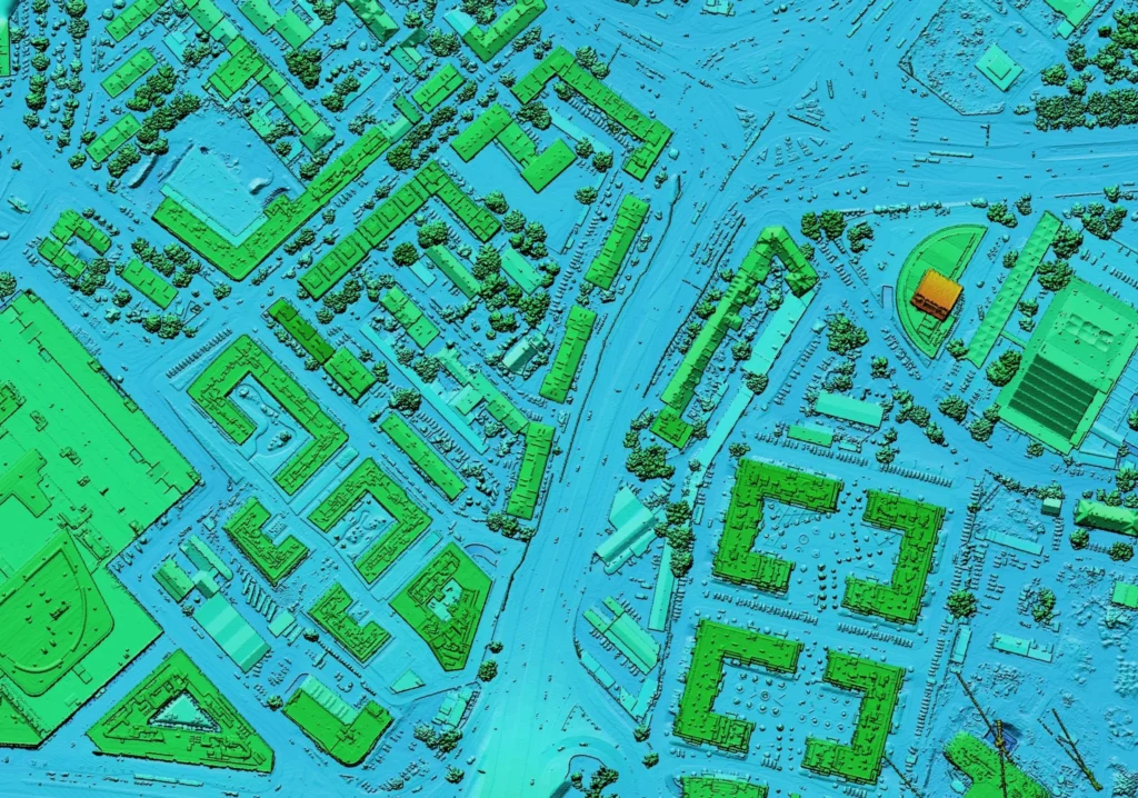
3D Map Creation and Scanning:
With DGN Robotic’s technology , we create 3D views of the worksite and obtain an orthophotographic map.
Your model can be continuously updated and stored online. This enables you to interactively view, show and annotate your worksite. This provides better control over the work progress of the construction, as well as the ability to provide stakeholders and clients with the most recent visual information.
Aerial photography, video, and 3D mapping can be used to provide visuals for marketing purposes, or for clients. This can also be used to bring the site to engineers, saving significant amounts of time for project engineers and planners. It removes conflicts before they can even arise.
3D Scanning of Construction Projects:
A 3D model of a construction project makes every detail available for viewing online. The model can also be used in any further planning, such as landscaping, interior design, or remodeling.
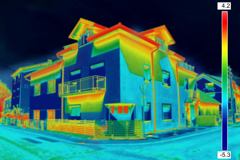
Structural Integrity Maintenance:
Regular checks of the site can aid in identifying and inspecting any possible structure vulnerabilities. Identifying and inspecting vulnerabilities eliminates potential problems regarding safety and saves you from legal liability.
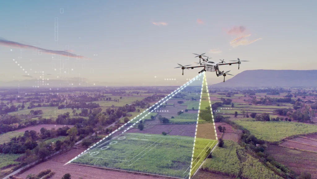
Volumetric Surveying
Volumetric Measurement/Estimation:
Aerial photogrammetry can be used to scan large areas (2D and 3D) with very high accuracy. This is a quick, cost effective, and minimally disruptive process to the day-to-day workings of the site.
Additionally, any unwanted changes in the job site, such as soil movement can be easily detected with a quick comparison that would usually take hours or days of surveying.

What are Volumetric Surveys?
Volumetric surveys are a type of topographic survey conducted to accurately quantify the volume of a specific area, such as a stockpile/containment area, or cut and fill calculations/analysis, and more. They are an essential tool for measuring and managing resources and bulk materials.
At DGN Robotics, we utilize UAV technology to obtain data for our clients and their projects and are equipped to deliver in a matter of hours. With drone technology, we guarantee that surveys are quick and cost-effective, especially in comparison to ground-based surveys and the manual labor and risks involved.
Volumetric Survey Applications:
Topological Measurements: Using RTK/PPK, we can gather highly accurate elevation data.
Cut and Fill Analysis: Quickly identify where and how much you need to move materials.
Change Monitoring: Compare older measurements and find undergroud erosion, or track progress.
Flood Analysis: Simulate water runoff, identify problem areas and plan around them.
Inventory Management: Measure the volume and mass of stockpiles to aid in inventory management and plan production in short timeframes.
Measure everything.
The powerful web viewer gives you fast insights without having to leave the office.
Turnaround time
From site visit to topological data: 24 hours.
GSD
Ground Sampling Distance: 3cm/Pixel down to 0,8 cm/Pixel.
Accuracy
± 2cm vertical error.
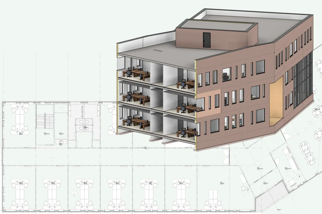
Scan-to-BIM

BIM is an acronym for Building Information Modeling or Building Information Management.
It is a process that allows architects, real estate developers, contractors, engineers, manufacturers, and other construction professionals plan, design, and construct a 3D model of a structure or building.
Scan to BIM is the process of digitally capturing a target site through Photogrammetry and 3D laser scanning, and using the data to create a BIM model.
Drones are used to take images from all angles, and by combining its GPS coordinates and Structure From Motion algorithms to create a detailed point cloud.
Laser scanners, also called LiDAR scanners, measure and record distances using precise laser pulses, and also create a point cloud.
Utilizing these, we create Building Models using Revit (.rvt file), and fill building elements with metadata, like thermal coefficients, vendor data, and others. We are able to interface a variety of software like energy planning software or enhance the model even more utilizing Digital Twins and IoT sensors.
Contact us for a consultation
Have any questions? Send us a message and we’ll call you.