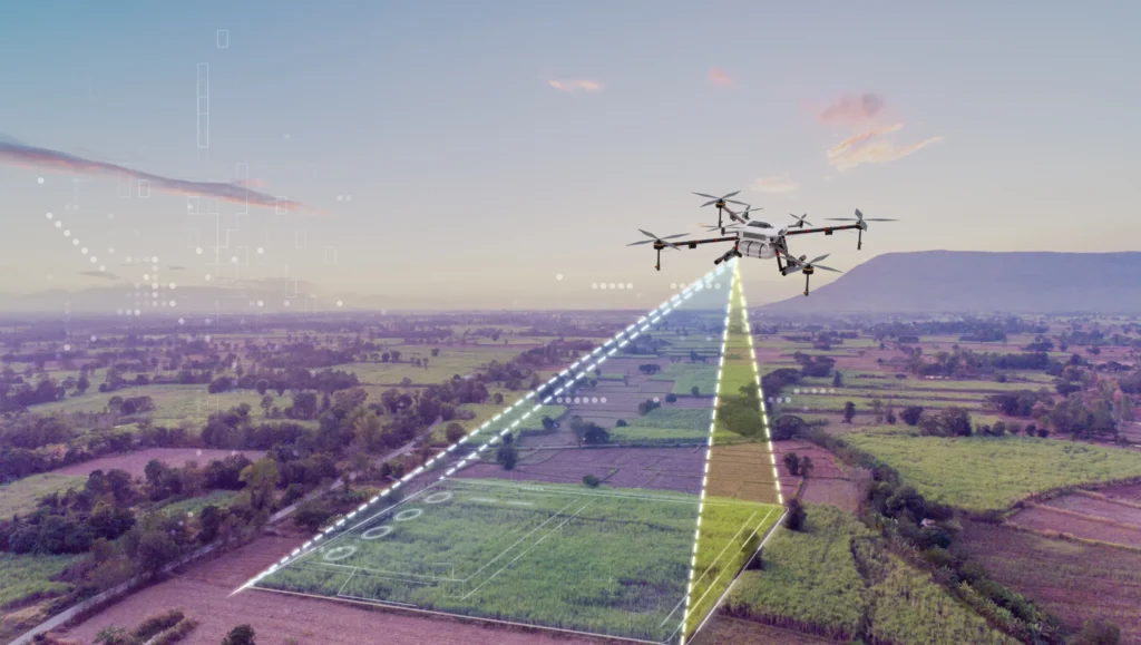
Kommerzielle Drohnendienste
In einer Zeit von neuen Herausforderungen ist der Einsatz neuer Technologien keine Option, sondern eine Notwendigkeit. Luftgestützte Scans bieten eine bemerkenswerte Mischung aus Innovation und Praktikabilität.
Von der Baustellenüberwachung über Umweltprüfungen und Infrastrukturinspektionen bis hin zum Building Information Modeling - DGN ist darauf spezialisiert, Ihnen schnell und effizient wertvolle Daten zu liefern.
Baufortschritt-Monitoring
Baufortschritt-Monitoring
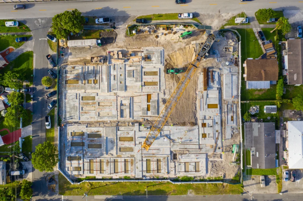
Drohnen im Bauwesen
Unter den technologischen Innovationen des letzten Jahrzehnts haben sich Drohnen als beliebtes Werkzeug im Bauwesen erwiesen, um Arbeitsabläufe zu optimieren, die Koordination zwischen Fachleuten zu verbessern und Risiken auf der Baustelle zu mindern.
Das Baugewerbe gehört zu den Branchen, in denen die Leistung und Effizienz in einer Reihe von praktischen Aspekten - wie Vorplanung, detaillierte Vermessung, Kartierung der Baustelle, Bauüberwachung, Kontrollen nach dem Bau sowie Vertrieb und Marketing - erheblich verbessert werden kann.
Bei erfolgreicher Implementierung und Nutzung der bereitgestellten Daten und Tools können unsere Dienstleistungen Sicherheit auf der Baustelle verbessern, Risikofaktoren reduzieren,⠀ Profitabilität erhöhen, Zeit sparenund virtuelle Daten sammeln, die Sie jahrzehntelang für die zukünftige Entwicklung, Planung und Vermarktung nutzen können.
DGN Robotics bietet vollständig automatisierte, geplante Flugpfade des gewünschen Gebietes, um Bauherren, Bauplanern, Auftraggebern und -nehmern vor Ort nahezu in Echtzeit visuelle Fortschrittsberichte zu liefern.
Sie können dies zu jedem Zeitpunkt der Entwicklungsphase tun, sogar bevor die Bauarbeiten auf der Baustelle beginnen. Wichtige Meilensteine in der Bauphase können festgehalten werden und die Beteiligten auf den neuesten Stand bringen, was die Rechenschaft erhöht und den Fortschritt auf der Baustelle anzeigt.
Regelmäßige Updates
Direkt zugestellt oder per Web-Viewer.
Dokumentation
Independent & detailed Quality Control from all angles,
Schnelle Daten
Einmal automatisiert, können Sie innerhalb eines Tages Daten erhalten.
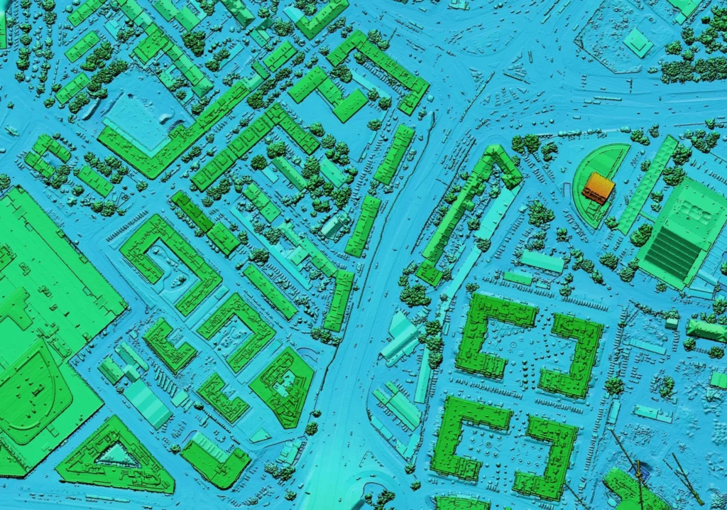
3D Mapping und Scanning:
Mit der Technologie von DGN Robotics erstellen wir 3D-Ansichten ihrer Anlage und erhalten eine orthographische Karte.
Ihr Modell kann regelmäßig aktualisiert werden und online gespeichert werden. Damit können Sie Ihr Gebiet interaktiv ansehen, vermessen, kommentieren und teilen. Dies ermöglicht eine bessere Kontrolle des Baufortschritts sowie die Bereitstellung aktueller visueller Informationen für Beteiligte und Kunden.
Aerial photography, video, and 3D mapping can be used to provide visuals for marketing purposes, or for clients. This can also be used to bring the site to engineers, saving significant amounts of time for project engineers and planners. It removes conflicts before they can even arise.
3D Scanning of Construction Projects:
A 3D model of a construction project makes every detail available for viewing online. The model can also be used in any further planning, such as landscaping, interior design, or remodeling.
Structural Integrity Maintenance:
Regular checks of the site can aid in identifying and inspecting any possible structure vulnerabilities. Identifying and inspecting vulnerabilities eliminates potential problems regarding safety and saves you from legal liability.
Volumetrische Vermessung
Volumetric Measurement/Estimation:
Aerial photogrammetry can be used to scan large areas (2D and 3D) with very high accuracy. This is a quick, cost effective, and minimally disruptive process to the day-to-day workings of the site.
Additionally, any unwanted changes in the job site, such as soil movement can be easily detected with a quick comparison that would usually take hours or days of surveying.

What are Volumetric Surveys?
Volumetric surveys are a type of topographic survey conducted to accurately quantify the volume of a specific area, such as a stockpile/containment area, or cut and fill calculations/analysis, and more. They are an essential tool for measuring and managing resources and bulk materials.
At DGN Robotics, we utilize UAV technology to obtain data for our clients and their projects and are equipped to deliver in a matter of hours. With drone technology, we guarantee that surveys are quick and cost-effective, especially in comparison to ground-based surveys and the manual labor and risks involved.
Volumetric Survey Applications:
Topological Measurements: Using RTK/PPK, we can gather highly accurate elevation data.
Cut and Fill Analysis: Quickly identify where and how much you need to move materials.
Change Monitoring: Compare older measurements and find undergroud erosion, or track progress.
Flood Analysis: Simulate water runoff, identify problem areas and plan around them.
Inventory Management: Measure the volume and mass of stockpiles to aid in inventory management and plan production in short timeframes.
Measure everything.
The powerful web viewer gives you fast insights without having to leave the office.
Turnaround time
From site visit to topological data: 24 hours.
GSD
Ground Sampling Distance: 3cm/Pixel down to 0,8 cm/Pixel.
Accuracy
± 2cm vertical error.
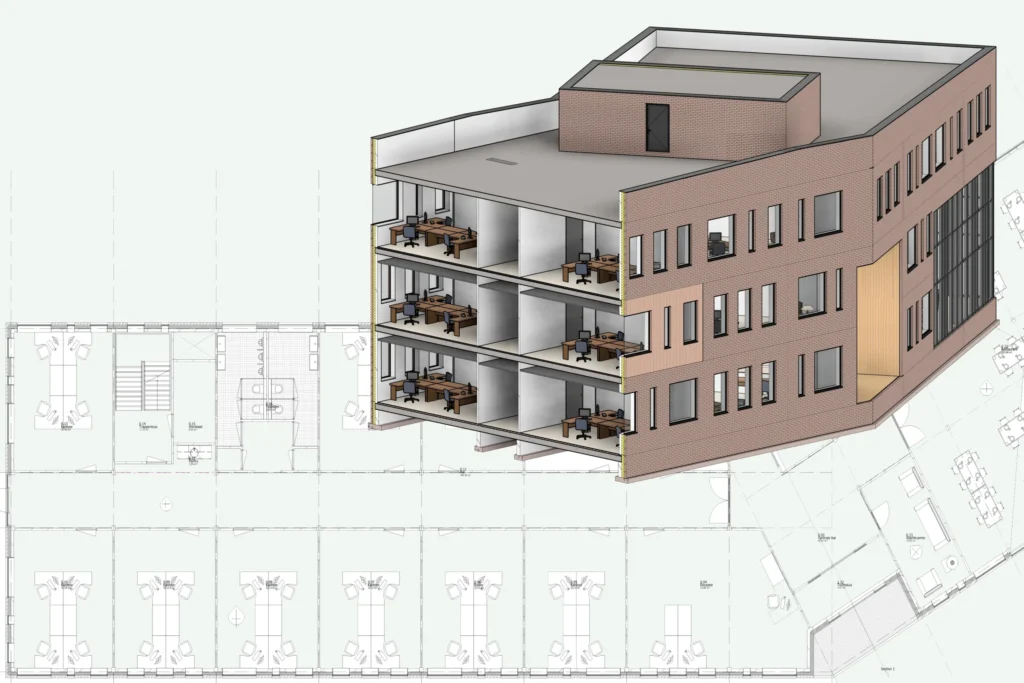
Scan-to-BIM

BIM is an acronym for Building Information Modeling or Building Information Management.
It is a process that allows architects, real estate developers, contractors, engineers, manufacturers, and other construction professionals plan, design, and construct a 3D model of a structure or building.
Scan to BIM is the process of digitally capturing a target site through Photogrammetry and 3D laser scanning, and using the data to create a BIM model.
Drones are used to take images from all angles, and by combining its GPS coordinates and Structure From Motion algorithms to create a detailed point cloud.
Laser scanners, also called LiDAR scanners, measure and record distances using precise laser pulses, and also create a point cloud.
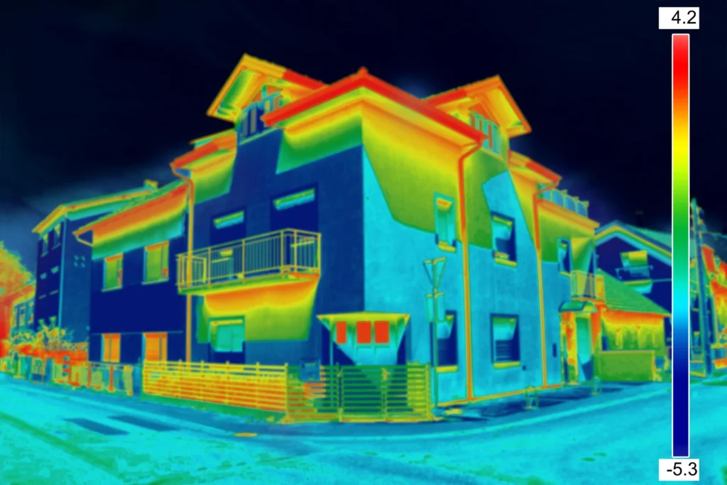
Utilizing these, we create Building Models using Revit (.rvt file), and fill building elements with metadata, like thermal coefficients, vendor data, and others. We are able to interface a variety of software like energy planning software or enhance the model even more utilizing Digital Twins and IoT sensors.
Contact us for a consultation
Have any questions? Send us a message and we’ll call you.